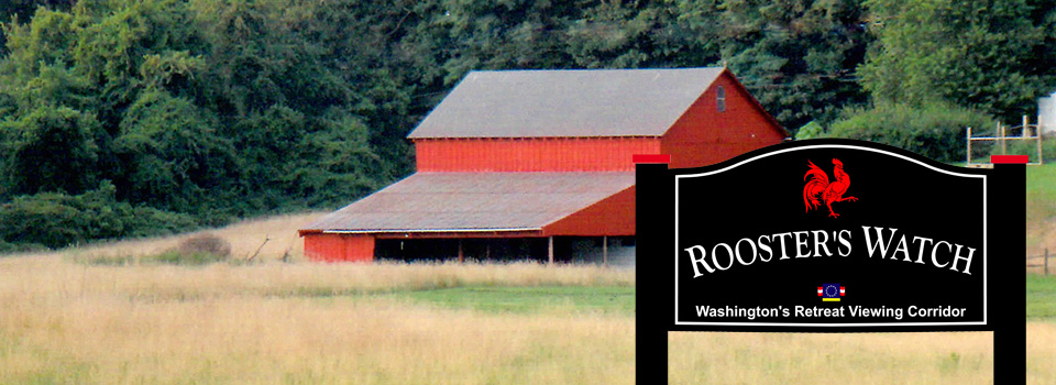
Rooster's Watch...the History
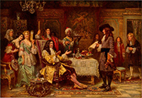 Birth of Pennsylvania, 1680, by Jean Leon Gerome Ferris
Public records indicate that in 1681, this 15.4 acre parcel started its division process as an integral part of a 1350 acre piece of a 5000 acre land grant from William Penn to John Simcock. Prior to 1681 King Charles of England owned all this part of the country. This area had no townships or cities and it appears was only inhabited by a few Swedish settlers and the Lenape Indians. To satisfy the 16,000 pound debt King Charles II owed Admiral Sir William Penn’s Estate, young William asked for and was granted the Province of Pennsylvania. The land mass was 45,000 square miles, an area larger than Ireland and almost as large as the whole of England.
William Penn offered to sell to the colonists five thousand acres for one hundred pounds. John Simcock evidently took him up on that offer. Side note: 16,000 pounds in 1681 translates to a relative value of $3,282,000 in 2013 dollars. One hundred pounds in 1681 translates to a relative value of $20,512 +/- in 2013 dollars.
The Battle of Brandywine
 Sons of Liberty Flag, 1775
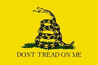 Gadsden Flag, 1775
The history of this entire Chester/Delaware County area is significant. Most people arriving in Pennsylvania after 1681 landed in Upland (now Chester) and many worked their way up through this region. The Battle of Brandywine, one of the largest and most pivotal Revolutionary War battles, was fought here. Dilworthtown Road was one of several routes approximately 17,000 of our American Forces along with their horses, wagons, and camp followers took as they retreated from the battle that day. This strategic retreat took place in the late afternoon and well into the night of September 11, 1777. The footsteps of the Forces who walked here took them through Thornton, some stopping at Yellow House for field hospital care, others continuing to Chester.
» Combat Sites and Troop Movement Maps of The Battle of Brandywine
» Rearguard Defense and George Washington’s Strategic Retreat
» Chester and Delaware Counties Brandywine Battlefield Preservation Plans and Recommendations
» Brandywine Battlefield Animated Map
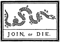 Join or Die Ben Franklin Cartoon, 1754
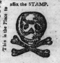 Stamp Act Protest Seal, 1765
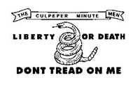 Culpepper Flag 1775
Brandywine Battlefield Landmark Preservation
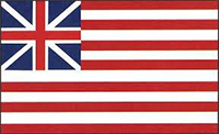 Grand Union-Continental Colors, used until 1777 is considered to be the first National Flag
In 1993 a group The Brandywine Battlefield Task Force, was founded over concerns of losing the historically significant Battlefield landmark. Rising land prices and taxes garnered continued development pressure on private owners of larger tracts of ground within this Brandywine Battle area. This was resulting in much ground being lost forever, to development. According to the Civil War Trust www.civilwar.org, our nation is losing, at an alarming rate, approximately one acre of hallowed ground, to development, every hour.
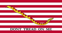 First U.S. Navy Jack, 1776
The Task Force is a volunteer group representing local governments, nonprofit organizations, historical groups, regional planning agencies, and concerned residents of the area. Its mission is “the implementation of public and private partnerships to preserve the ten square-mile Brandywine Battlefield Landmark, to educate the community about its cultural resources, and to develop interpretation of the battle and its historical and physical setting.” That mission also includes the historically significant pieces of ground outside that ten square-mile landmark.
“We preserve these sites so that our natural history may continue as a living presence” 2007 NPS Report to Congress
 Brandywine Battlefield Flag, 1777
The portion of Dilworthtown Road from Route 202 to Thornton Road and its surrounding lands are part of that historically significant Battlefield landmark. The ground of Rooster’s Watch is part of a current study to better define what happened here on the day of the battle. We do know our American forces and camp followers did have a strategic retreat that afternoon and evening. We do know a number of those forces walked down Dilworthtown Road, right past and most likely on this ground. This is the reason for the sign we have placed on the site, the one that states at the bottom “Washington’s Retreat Viewing Corridor” This sign is standing to alert the public to the importance of this area, remind them of the American Revolution and to honor those who served for our freedom.
2013 to Current Environmental, cultural, historical and personal land stewardship... Our Responsibility
 Hopkinson Six Pointed Star Flag, (Prior to Betsy Ross), 1777
Because of our knowledge of area history and desire to preserve it for future generations, we chose to try to have this ground saved as open space. After all, view sheds and open parcels with such a history, in this area, are rare. The education received from that experience of seeking help to preserve the open space reinforces the reason the Brandywine Battlefield Task Force was founded.
The next option was to take the ground through subdivision. Several ideas were viable for subdivision. The most profitable and most destructive idea was for seventeen or eighteen lots with a road. This method would have a road down the middle of the fields, connecting Westtown-Thornton Road to Dilworthtown Road. This method also guaranteed complete ruination of any view sheds and destruction of natural habitat let alone the tranquility of the surrounding neighborhood. The wildlife that abounds here would also be greatly diminished.
 Betsy Ross Flag, most likely after 1780
We felt we had a responsibility to take a more conservative approach. That approach would yield six lots with long private driveways. Each house would be situated to enhance its personal view shed as well as the view sheds enjoyed by the public. By designing this way the natural habitat would remain similar to what it is currently and the wildlife that abound here will continue to enjoy their travel and nesting areas. The three lots on Dilworthtown road are placed with their houses set deeply off the road, guaranteeing privacy for the homeowners, very useable and peaceful lots and leaving the areas our September 11, 1777 forces walked by and most likely on, alone.
Delaware County Thornbury, the township
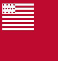
 Current American Flag
 Never Forget
To find out more about this area go to the Thornbury Delaware County Website at www.thornbury.org. For more history on that site, go into the Historical Commission portion and find the link to the Brandywine Battlefield Preservation Plan. That link will give anyone interested more than a few hours of information. We list many more links on that site which will introduce you to our historical partners in education.
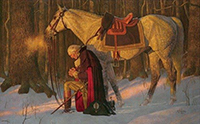 The Prayer at Valley Forge, 1975
by Arnold Friberg ©FribergFineArt
“When the well is dry we know the worth of water” – Ben Franklin